
Excerpt:
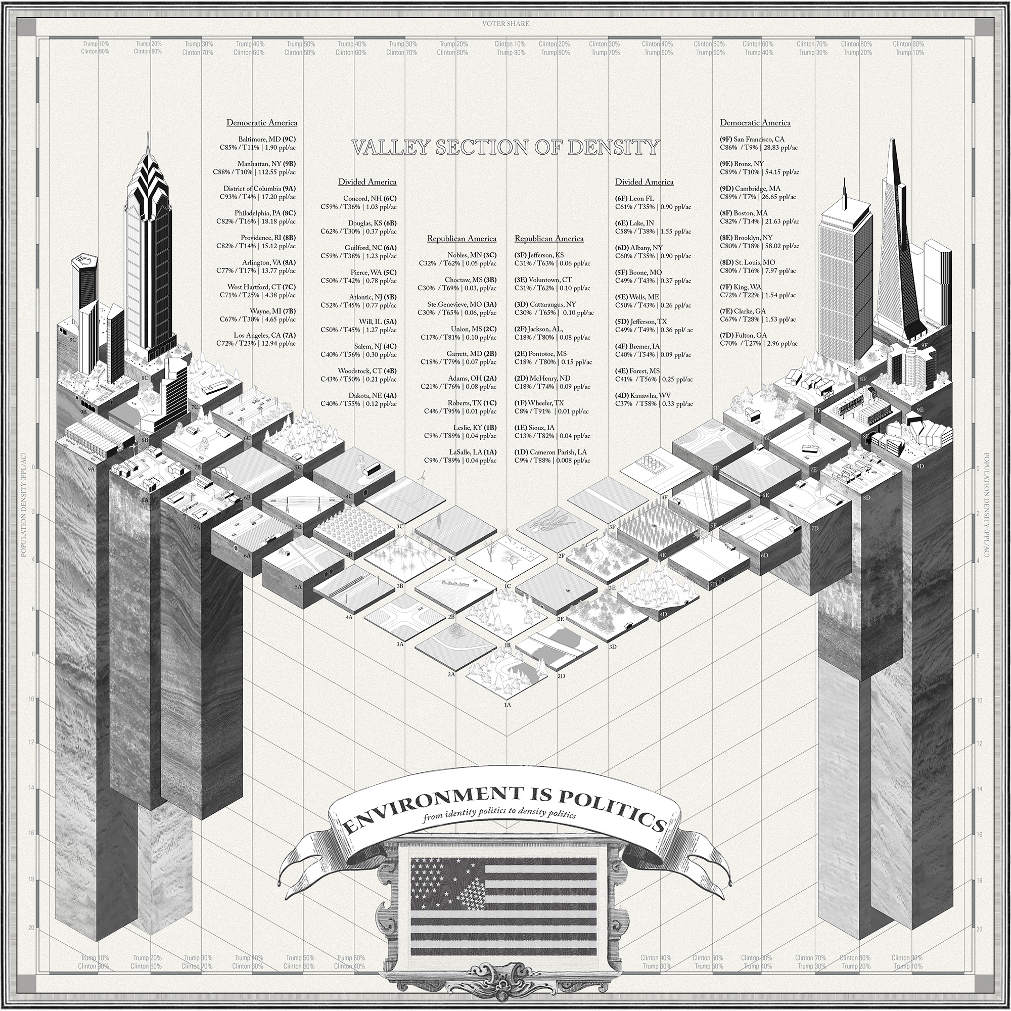
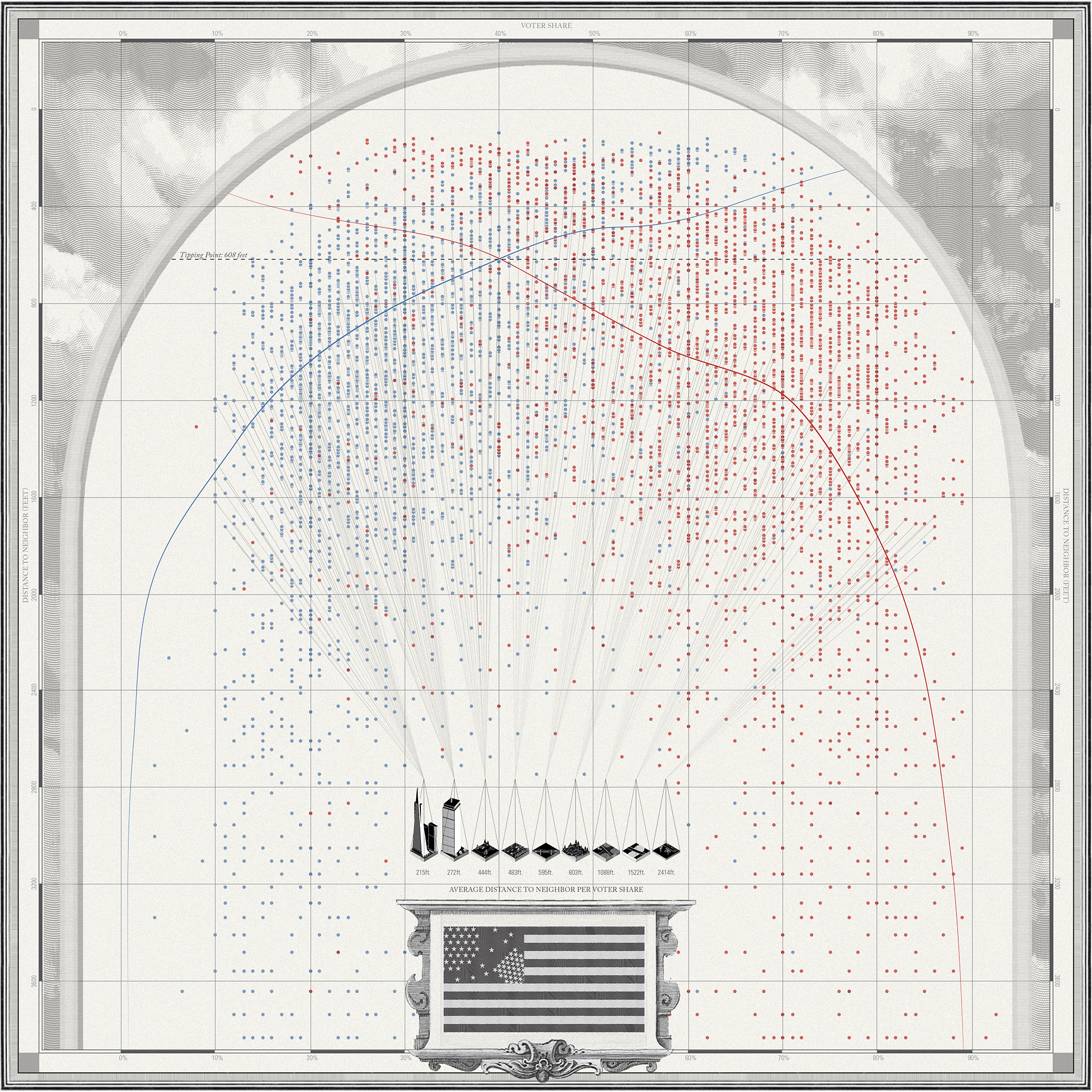
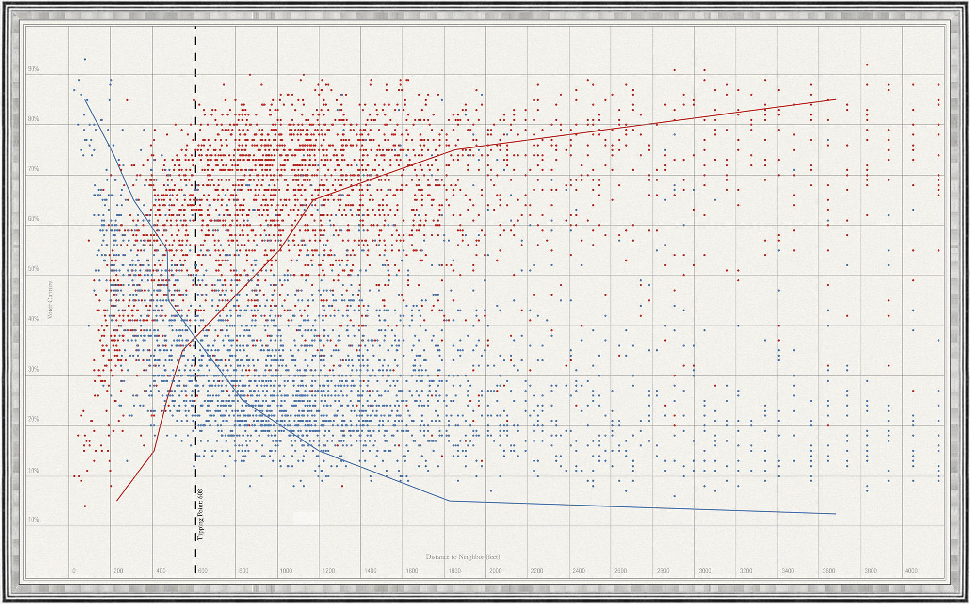
“One lesson of the U.S. presidential election is that we should forget about red and blue states, North and South, coastal coffeeshops and heartland diners. The geographic divide in American politics is closer to home. If you want to predict how someone will vote, ask, How near are your neighbors?
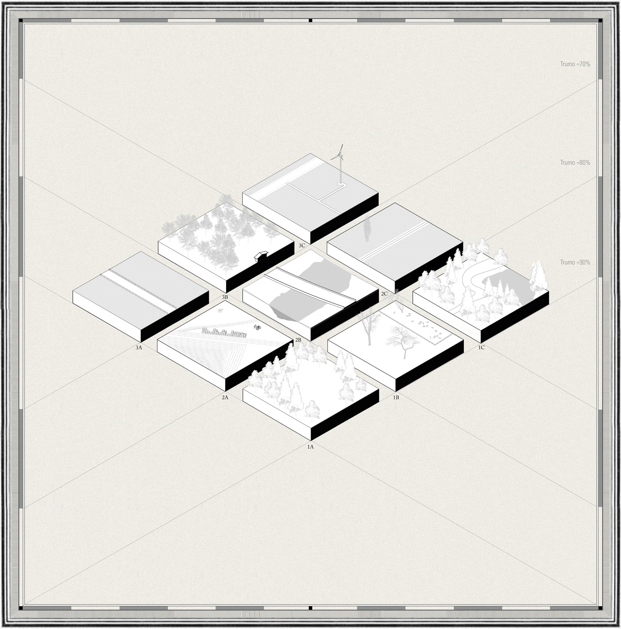
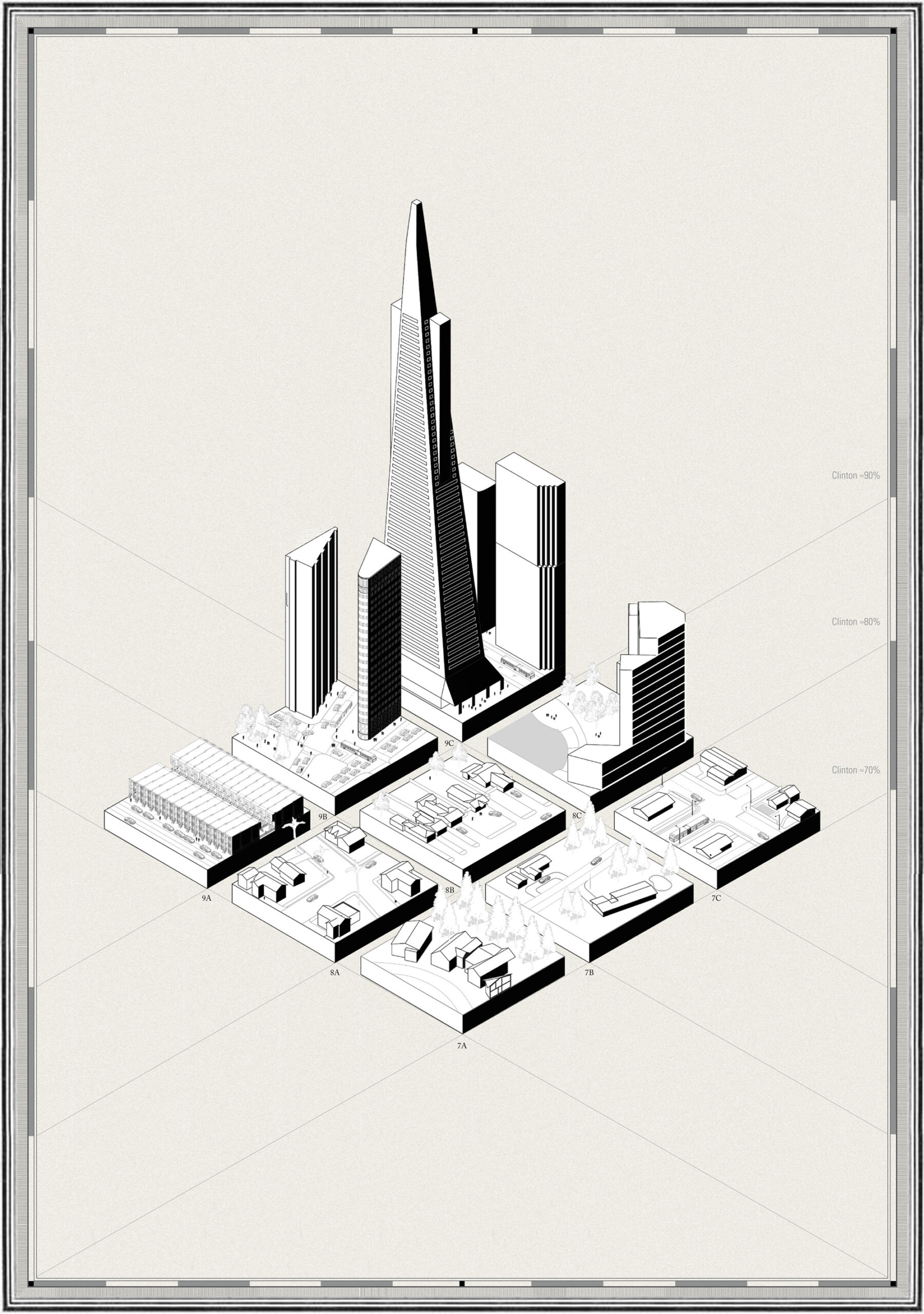
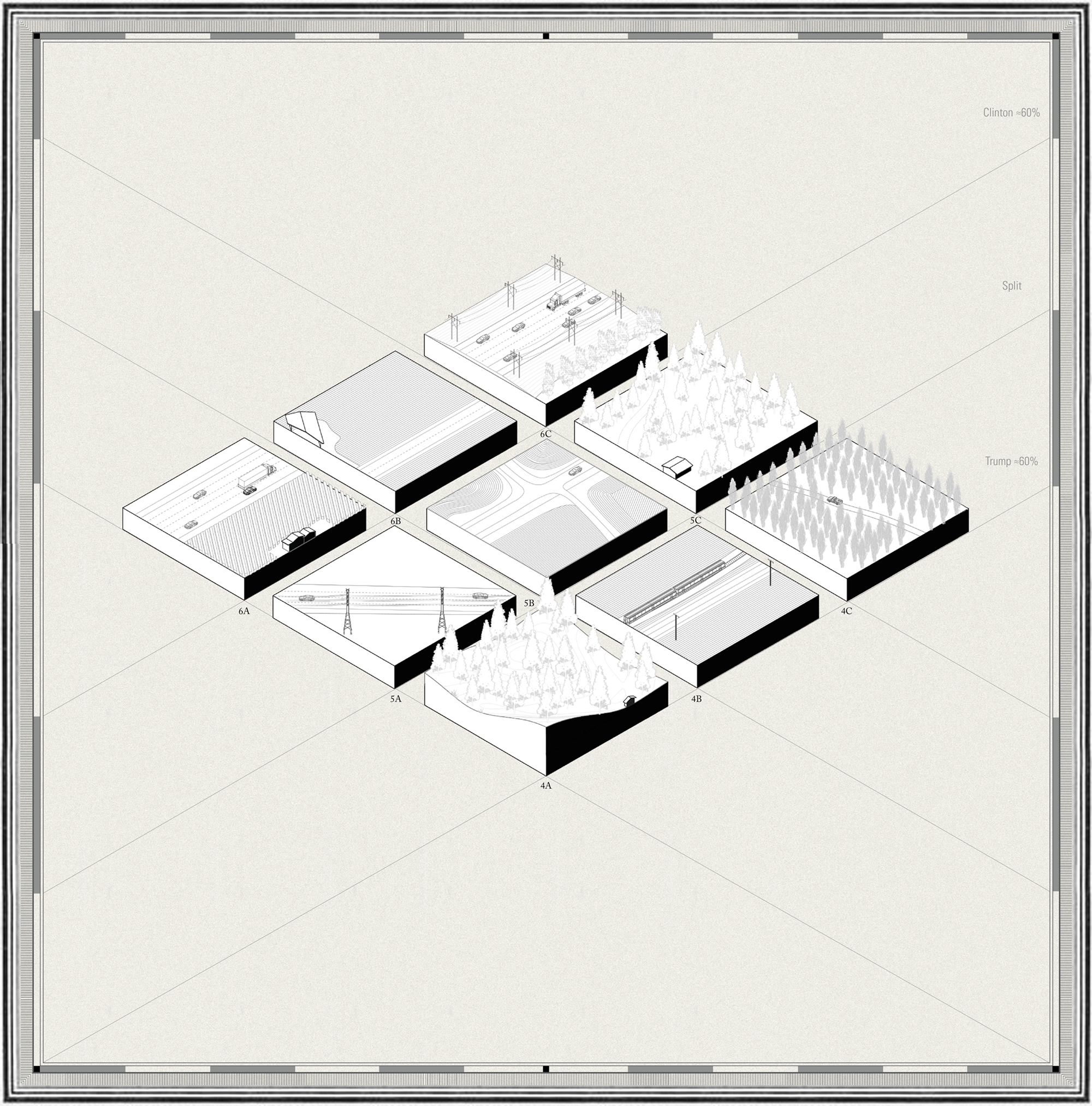
Residential density has long played a role in shaping American politics. In the recent election, 49 of the 50 highest density counties voted for Hillary Clinton, and 48 of the 50 lowest density counties chose Donald Trump (nearly the same split as for Barack Obama and Mitt Romney four years earlier). 1 In “blue” California, the agricultural towns of the Central Valley swayed Republican, while in “red” Texas the big cities voted Democratic. Across the spectrum of purple hues, a high-resolution map of population density closely matches voting results.”